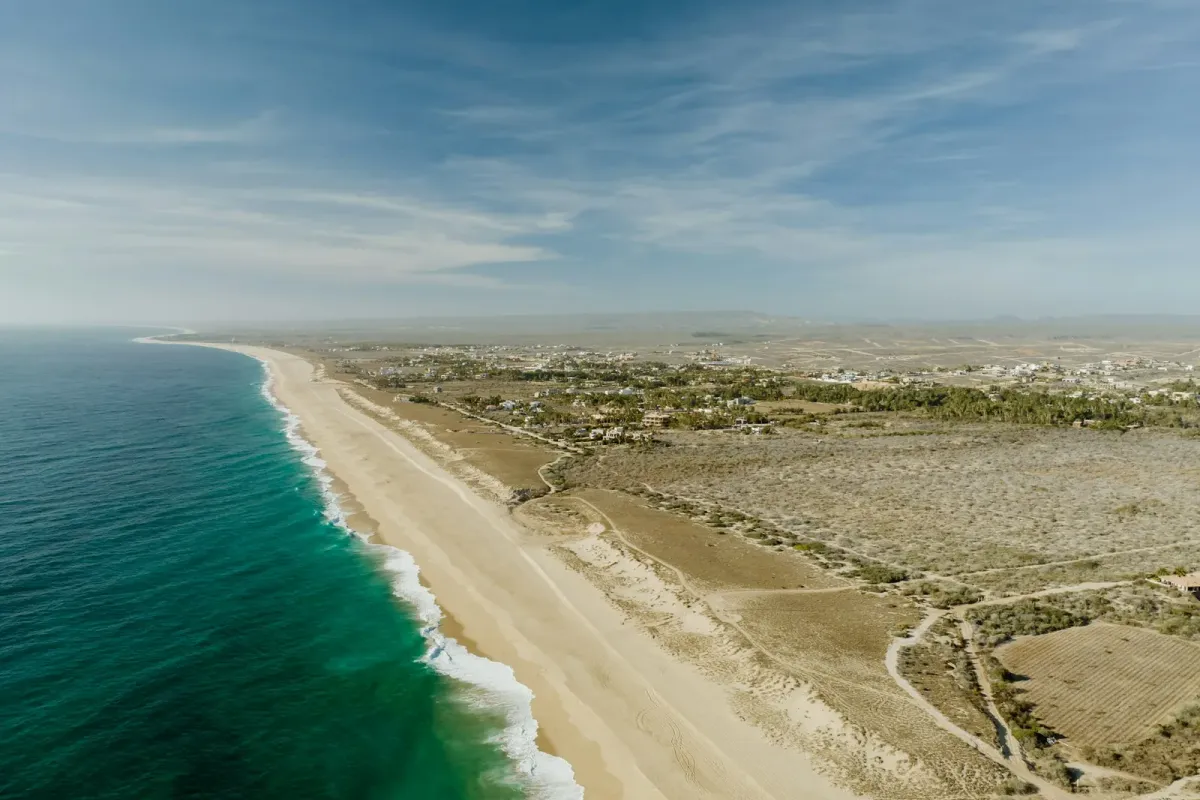
About Todos Santos, Mexico
This enchanting Pueblo Mágico nestled between the Sierra de la Laguna mountains and the Pacific Ocean captures the essence of Baja California Sur with its perfect blend of colonial Mexican heritage, artistic spirit, and pristine natural landscapes. Once a sugarcane mission, the town evolved into an under-the-radar luxury destination attracting artists, surfers, and sophisticated travelers seeking authenticity without sacrificing comfort. The palm-lined historic district reveals colorful colonial architecture housing art galleries, design boutiques, and farm-to-table restaurants like Jazamango by celebrated chef Javier Plascencia. Discerning visitors appreciate boutique accommodations such as Hotel San Cristóbal and Paradero, offering refined desert-meets-sea aesthetics. The surrounding region provides exclusive experiences from whale watching in the Pacific (December-April) to private tours of organic farms and vineyards in the fertile valley, while legendary surf breaks like Cerritos Beach attract wave enthusiasts. This multifaceted destination embodies laid-back luxury where cultural richness complements extraordinary natural beauty.
Todos Santos, Mexico Weather Guide by Month
Arid desert climate with hot summers (Jun-Sep) and warm winters (Dec-Apr) on Baja California Pacific coast with unique microclimate created by Pacific Ocean influence and desert mountain backdrop. Position outside Mexican monsoon system creates minimal rainfall while ocean proximity moderates desert temperature extremes.
Monthly Temperature Guide
| Month | High (°F) | Low (°F) | Season |
|---|---|---|---|
| Jan | 78° | 56° | Peak Season |
| Feb | 79° | 57° | Peak Season |
| Mar | 81° | 59° | Peak Season |
| Apr | 84° | 62° | Peak Season |
| May | 86° | 66° | Shoulder Season |
| Jun | 89° | 70° | Shoulder Season |
| Jul | 92° | 74° | Low Season |
| Aug | 92° | 74° | Low Season |
| Sep | 91° | 73° | Low Season |
| Oct | 88° | 69° | Low Season |
| Nov | 84° | 63° | Shoulder Season |
| Dec | 79° | 58° | Peak Season |
Best Time to Visit Todos Santos, Mexico
Peak Season
Months: December, January, February, March, April
Conditions: Perfect desert-coastal conditions with comfortable temperatures and minimal rainfall ideal for exploring artistic community and pristine beaches. Pacific Ocean moderates desert extremes while maintaining excellent conditions for outdoor activities and cultural exploration. Optimal weather for desert landscapes and beach access.
Peak season offers optimal weather conditions but expect higher prices and larger crowds. Book accommodations and activities well in advance for the best Todos Santos, Mexico experience.
Shoulder Season
Months: May, June, November
Conditions: May and June offer ideal conditions before summer heat intensifies, with perfect weather for exploring desert landscapes and Pacific beaches. Excellent timing for experiencing local art scene and outdoor activities while temperatures remain comfortable for diverse pursuits. November brings relief from summer heat with comfortable temperatures returning. Perfect period for exploring desert hiking trails and Pacific beaches as conditions become ideal for outdoor adventures. Art galleries and cultural sites showcase excellent accessibility.
Shoulder season provides an excellent balance of good weather and fewer crowds, making it ideal for travelers seeking a more authentic Todos Santos, Mexico experience at moderate prices.
Low Season
Months: July, August, September, October
Conditions: Summer heat intensifies dramatically in desert regions, though Pacific proximity provides some moderation. Limited rainfall possible during North American monsoon season, though Baja remains largely outside monsoon influence. Many outdoor activities best limited to early morning hours.
Low season offers the best value for budget-conscious travelers. While weather may be less predictable, you'll enjoy lower prices and fewer tourists, allowing for a more intimate exploration of Todos Santos, Mexico.
Travel Information for Todos Santos, Mexico
Airport Information
Primary Airport: Todos Santos, Mexico (SJD)
Search flights to SJD from major US cities including New York (JFK, LGA, EWR), Los Angeles (LAX), Chicago (ORD), Miami (MIA), and San Francisco (SFO). Flight times vary by departure city, with direct flights available from major hubs.
Destination Categories
Type: Tranquil, Culture, Coastal
Perfect for travelers seeking Tranquil and Culture and Coastal experiences. Todos Santos, Mexico offers diverse attractions and activities suited to various travel styles and interests.
Why Choose Roam Daniels for Your Todos Santos, Mexico Experience
Expert Destination Planning
Our travel specialists possess deep knowledge of Todos Santos, Mexico, including optimal travel timing, exclusive experiences, and insider access to luxury accommodations. We leverage weather patterns, seasonal considerations, and local partnerships to craft your perfect Todos Santos, Mexico itinerary.
Preferred Partner Properties
Experience Todos Santos, Mexico through our curated network of luxury hotel partners. Access exclusive amenities, room upgrades, and personalized services unavailable through standard bookings. Our partnerships ensure exceptional accommodations that match Todos Santos, Mexico's unique character.
Personalized Travel Curation
Every Todos Santos, Mexico itinerary is tailored to your travel preferences, whether you're seeking Tranquil, Culture, Coastal or cultural immersion. We consider weather patterns, seasonal attractions, and your personal interests to optimize your visit.
Exclusive Access & Benefits
Our established relationships in Todos Santos, Mexico provide access to exclusive experiences, private tours, and luxury accommodations with special amenities. From weather-optimized itineraries to insider restaurant reservations, we ensure your Todos Santos, Mexico journey exceeds expectations.
Plan Your Trip to Todos Santos, Mexico
Ready to explore Todos Santos, Mexico? Use our interactive travel planner to discover more destinations and plan your perfect trip based on weather, interests, and travel style.
Explore Interactive Map